Hydrographic Survey in Cairns
Precision Mapping Expertise
Advanced Drone Solutions
Marine Inspection Solutions
Fast Turnaround
Time
Precision Mapping Below the Surface
Hydrographic survey services are critical for managing marine and inland waterways, supporting infrastructure projects, environmental compliance and safe navigation.
At Tailored Spatial Solutions, based in Queensland, we deliver comprehensive hydrographic data using a combination of multibeam, single beam and side scan sonar technologies. Our team works across a wide range of environments including ports, rivers, reservoirs and coastal zones, providing accurate, real-time information to support engineering design, dredging operations, construction planning and asset inspections.
Each survey is tailored to suit the unique conditions of the site, from shallow water profiles to full bathymetric modelling. We focus on providing usable data that integrates seamlessly with GIS and CAD systems, reducing delays and improving project outcomes. Whether you need a simple depth profile or high-resolution imagery of the seabed, our team is equipped and ready to assist.
For reliable hydrographic survey support, contact us on (07) 4035 6510.
Your trusted partner in innovative spatial solutions.
Tailored Methods for Every Waterway
Our hydrographic surveys are customised to each environment and project scope. Using advanced sonar technology and experienced operators, we collect precise underwater data for use in planning, development and maintenance.
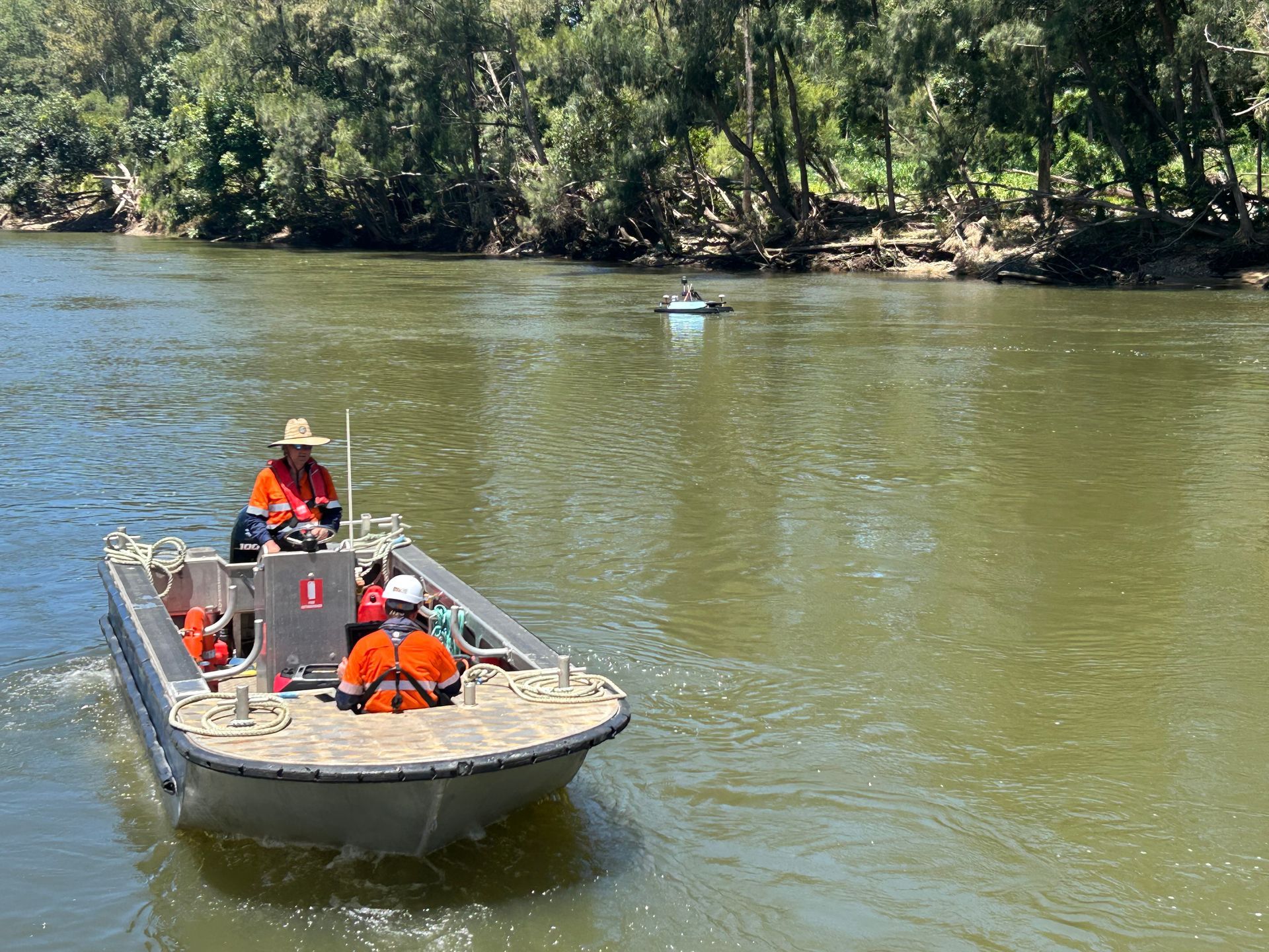
- USVs (Unmanned Surface Vessels) capture high-accuracy hydrographic data safely and efficiently, especially in challenging or hard-to-access areas, enhancing the quality and scope of every survey.
- Multibeam echo sounders capture a wide swath of the seabed in a single pass, delivering high-density bathymetric data. This method is ideal for mapping complex underwater terrain or calculating dredge volumes.
- Single beam echo sounders provide reliable depth profiles along a narrow transect. It’s a straightforward option for projects with simpler requirements or where multibeam coverage isn’t practical.
- Side scan sonar generates detailed imagery of the seafloor, detecting submerged objects, debris or hazards. This technique supports port maintenance, salvage operations and environmental assessments.
Each survey is completed using calibrated equipment and robust workflows to ensure high-quality results.
Supporting Infrastructure, Safety & Compliance
Tailored Spatial Solutions works across marine and inland water environments, including rivers, ports, reservoirs and coastal areas. Our team delivers hydrographic survey data to support:
- Marine construction & engineering
- Channel & harbour maintenance
- Asset inspections and reporting
- Pre- & post-dredging surveys
- Environmental monitoring and compliance
All data is processed using industry-standard software and provided in usable formats to suit GIS, CAD or BIM applications. We collaborate with project managers, government bodies and contractors to ensure your survey outcomes align with planning and regulatory requirements. With responsive service and flexible deployment, we’re ready to support your next marine project.
Our Projects
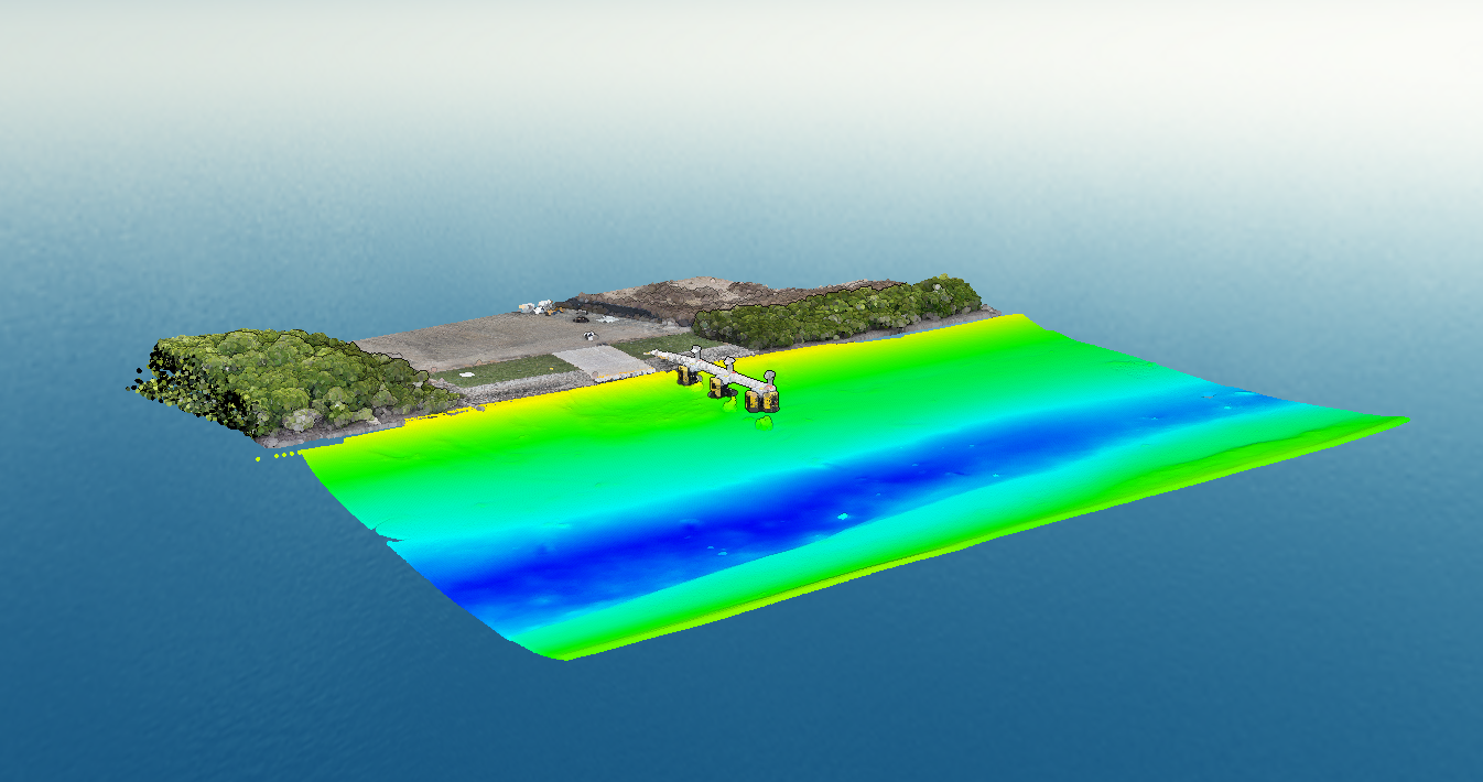
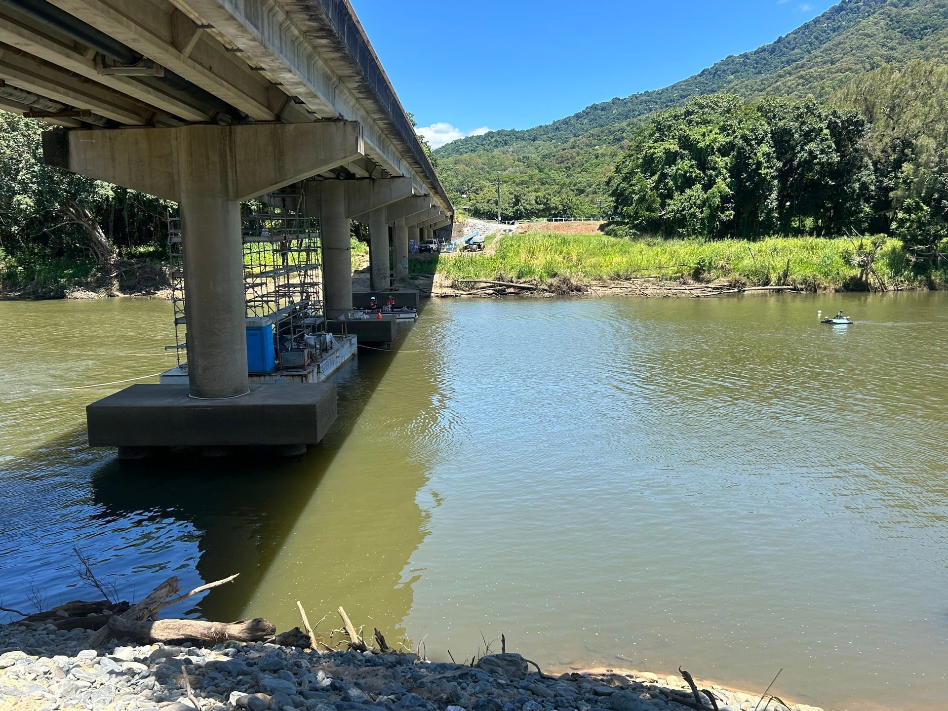
- Cane Train Bridge – Bathymetric Survey: We were engaged by GHD to assist MSF Sugar in locating the remains of a cane train bridge that was washed away during Cyclone Jasper. The project required a precise and efficient method to identify any submerged debris or structural elements left behind in the river.
We deployed our Unmanned Surface Vessel (USV) equipped with a NORBIT multibeam sonar and above water LiDAR to carry out a detailed bathymetric survey of the area. This technology allowed us to safely and accurately map the riverbed, identifying underwater anomalies and confirming the presence and location of the missing bridge components.
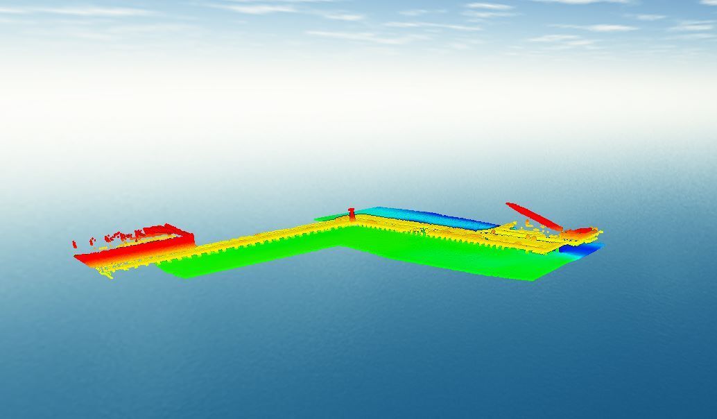
- HMAS Wharf Debris Survey – Cairns Navy Base: We were engaged by SMC Marine to carry out a seabed debris survey at the HMAS Wharf in Cairns. The objective was to identify any underwater obstructions or debris ahead of scheduled construction and maintenance activities.
Using our Unmanned Surface Vessel (USV) fitted with a NORBIT multibeam sonar system and above water LiDAR, we performed a high-resolution bathymetric survey of the wharf area. The survey allowed for precise mapping of the seafloor and detection of potential hazards, without disrupting base operations.
- Dolphin 1 Pylon Verification Survey – HMAS Dolphin One: We were contracted by SMC Marine to conduct a targeted bathymetric survey around Dolphin 1 at the HMAS Wharf. The primary objective was to verify the removal of all concrete pylons and accurately locate any remaining subsurface structures.
Deploying our USV with a high-resolution NORBIT multibeam sonar, we captured detailed underwater data of the site. This allowed us to confidently confirm the removal status of the existing